- Click on images to read map details and size
- Click on "template" to read the template source that generated the map. You can use templates as examples for requesting new maps.
Region: US_DALHART
Longitude -104.63 to -98.68 Latitude 33.5 to 38.5 (template)
Soaring Society of Boulder Dahart, TX annual encampment
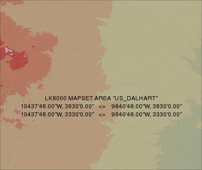
Terrain 500m DEM: US_DALHART_500.DEM
Terrain 1000m DEM: US_DALHART_1000.DEM
Topology: US_DALHART.LKM
Region: US_TEXAS
Longitude -100 to -93 Latitude 26 to 36 (template)
Texas
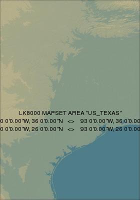
Terrain 1000m DEM: US_TEXAS_1000.DEM
Topology: US_TEXAS.LKM
Region: US_UVALDE
Longitude -100.73249 to -98.26299 Latitude 27.27826 to 31.34167 (template)
This map covers the 2012 World Gliding Championships task area, Uvalde, TX, with an 8km (5sm) buffer.
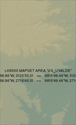
Terrain 250m DEM: US_UVALDE_250.DEM
Terrain 500m DEM: US_UVALDE_500.DEM
Terrain 1000m DEM: US_UVALDE_1000.DEM
Topology: US_UVALDE.LKM
This page was generated automatically by DoLKMaps on Fri Feb 17 18:47:07 CET 2017